This list of Baltimore neighborhoods includes the neighborhoods of Baltimore, Maryland, divided into nine geographical regions: North, Northeast, East, Southeast, South, Southwest, West, Northwest, and Central. Each district is patrolled by a respective precinct of the Baltimore Police Department.
Charles Street down to Hanover Street and Ritchie Highway serve as the east-west dividing line and Eastern Avenue to Route 40 as the north-south dividing line. Baltimore Street is the north-south dividing line for the U.S. Postal Service. It is not uncommon for locals to divide the city simply by East or West Baltimore, using Charles Street or I-83 as a dividing line.
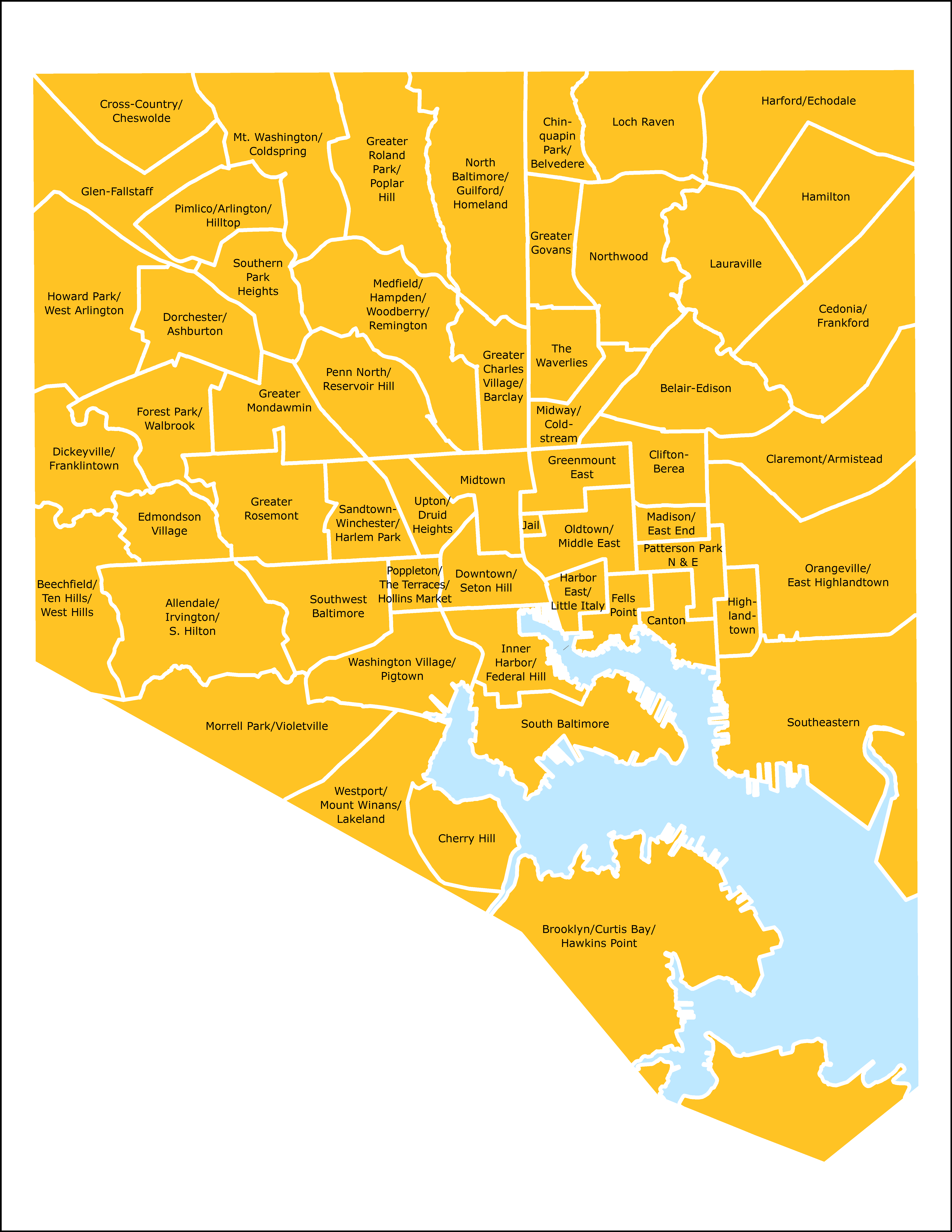
The following is a list of major neighborhoods in Baltimore, organized by broad geographical location in the city:
Baltimore neighborhoods
A list of the neighborhoods of Baltimore listed by planning district:
Northwest
North
Northeast
East and Downtown
- Baltimore Highlands
- Berea
- Biddle Street
- Brewers Hill
- Broadway East
- Butcher's Hill
- Canton
- Canton Industrial Area
- CARE
- Darley Park
- Downtown
- Downtown West
- Dundalk Marine Terminal
- East Baltimore Midway
- Ellwood Park/Monument
- Greenmount Cemetery
- Highlandtown
- Inner Harbor
- Johnston Square
- Madison-Eastend
- McElderry Park
- Milton-Montford
- Oliver
- Patterson Place
- South Clifton Park
- University of Maryland
Central
Southeast
South
Southwest
West
See also
- Chinatown in Baltimore
- Baltimore portal
References
External links
- Baltimore City iMap
- Baltimore's Neighborhood Statistical Areas (as of December 2016)
- Baltimore City Planning Districts (As of June 2016)
- The Baltimore Neighborhood Indicators Alliance
- Patterson Park Neighborhood Association website
- Live Baltimore website